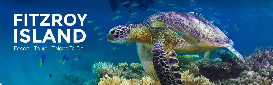


Fitzroy Island History
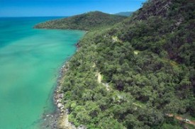
Fitzroy Island is a continental island that was connected to the mainland over 10,000 years ago. It originates as part of the coastal mountain range of Malbon Thompson Mountain Range located behind Cairns (which includes Bellenden Ker, Mount Bartle Frere and Walshes Pyramid).
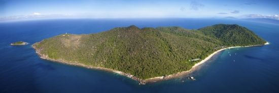
When the Ice Age ended (approx. 8,000 years ago) the rising waters from the melting ice caps flooded the valley between Fitzroy and the other mountain peaks. This left it an isolated island. Fitzroy Island is actually the top of a submerged mountain, many people do not realise that their island vacation actually takes place on the top of a mountain! Most of the island's water comes from a natural freshwater spring originating in the Tablelands near Mareeba, and surfacing in the National Park bush behind the main complex.
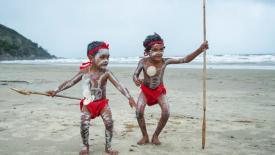
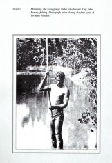
For thousands of years, the Aboriginal people on Fitzroy Island, the Gunganji people, gathered food, and used the area as fishing and hunting grounds. They believe the island is spiritually significant and that a person named Gulnyjarubay named the island Gabara, which means “the fist.” This symbolized that the lower portion of the island/mountain had been submerged and all that remained above water was “the fist.”
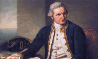
In 1770, Lieutenant James Cook named the island Fitzroy after the family name of the Duke of Grafton, who was Prime Minister of England at the time the Endeavour sailed. The point on the mainland opposite (Djilibiri) was also named Cape Grafton in his honour.
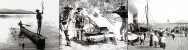
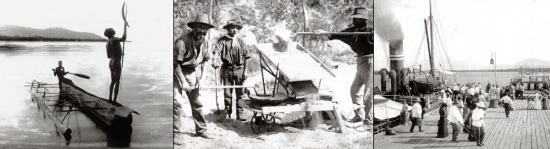
From the early 1800s Fitzroy Island was visited by pearling and surveying vessels irregularly until, in the late 1800s, a beche-de-mer (sea cucumber) industry operated from the island. Sea cucumbers were collected and prepared for the Asian food market.In 1876 Fitzroy Island become a quarantine station for Chinese 'coolies' en route to the Palmer River Goldfields. Conditions were poor and starvation, sickness and death were common. Many coolies were buried on the island but the location of most of the graves is unknown.
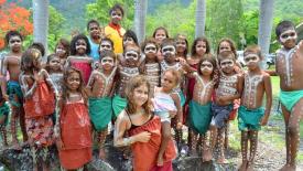
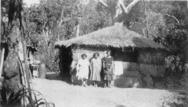
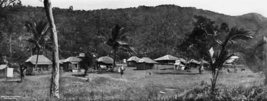
In the early 1900’s Fitzroy Island became part of the Anglican Aboriginal mission established at Yarrabah and was used to grow bananas, pawpaw, potatoes and cassava. Memories of family separations, attempted runaways, farming the island’s vegetable gardens and attending the coral church are kept alive by the old people of Yarrabah today. The Menmuny Museum at Yarrabah contains displays about the island’s mission days.
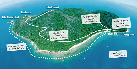
Over the years several ships were wrecked on the reefs near Fitzroy Island. The first navigation light, a carbide gaslight, was placed on Little Fitzroy Island in 1923. In 1943, a lighthouse was built on Fitzroy Island providing an important navigational service especially for wartime shipping. The remains of this lighthouse can be seen on the Summit walking track.
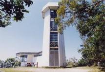
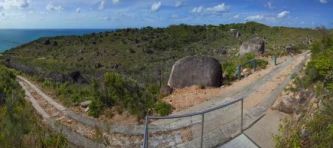
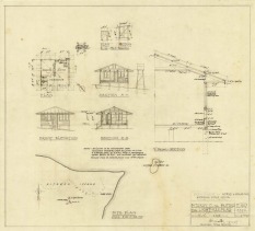
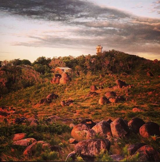
The lighthouse on the main island today was built in 1970 and stands on what was once the site of a radar station, established in 1942. The cottages (circa 1960) were home to the lighthouse keepers until the light was changed to an automatic system in 1991.The lighthouse on the main island is no longer in use and the lighthouse cottages are part of the national park. The Number 28 Radar Station, along with coastal artillery gun emplacements on Cape Grafton, served to protect Grafton Passage. Both were disbanded and removed at the end of the World War II. Today’s automated lighthouse is located on Little Fitzroy Island.
Take a hike to the lighthouse via a very steep service road (concrete wheel tracks) that begins from the north-east end of the camping area. A lookout on the windy north side of the island offers views of Green Island on a clear day. From the lighthouse you can enjoy expansive views of the ocean, and in winter you may be lucky enough to spot an occasional migrating humpback whale.
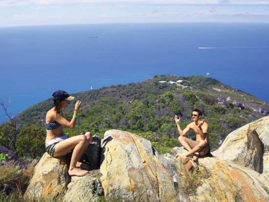
For 360 degree views of Fitzroy Island take the nearby Summit Track. This boulder-strewn track climbs for 600m through woodland to the summit. From here you can enjoy magnificent views over the island, surrounding reefs and mainland, which make this difficult walk well worth the effort! From the summit, the track then descends for 1.4 km through woodland and open heathland, returing to the north-east end of the camping area.
Most of the walking trails were formed during World War War II when the Island was converted into a military base to protect Australia’s mainland from invasion, hence their access to some of the best vantage points in the region. There has been both a Giant Clam farm at Welcome Bay and now a Tourist Resort and day visitor amenities.